Vegetation surveys
We are pleased to present a new beta feature of Pl@ntNet: the ability to create and explore vegetation surveys, also known as plots or quadrats. This feature is designed to help users interested in monitoring plant communities and performing basic vegetation analyses through the application.
A vegetation survey in Pl@ntNet includes the following elements:
-
The date of the survey
-
The author of the survey
-
The GPS coordinates of the study site
-
The flora of the study site
-
The EUNIS habitat of the study site
-
A square photo of the ground or vegetation (the quadrat)
-
The list of plant species present in the image
This feature allows naturalists, researchers, students, and citizen scientists to document and share plant assemblages in a standardized way.
How can I access this new feature?
Section titled “How can I access this new feature?”To access this beta feature, we need to authorize your Pl@ntNet account. Please fill out the following form: https://forms.gle/BYH7WC9d8eJEm3dk9. We will inform you as soon as your access is authorized, generally within 3 business days.
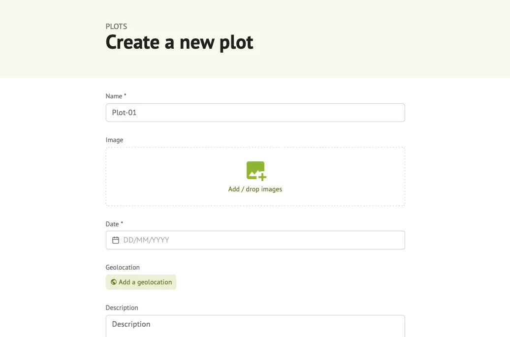
Creating a vegetation survey
Section titled “Creating a vegetation survey”To create a vegetation survey:
-
First, you must be logged in
-
At the top of the page, click the “Create” button and select “Plot”.
-
Fill out the form, only the title and date are required.
-
Optionally upload a square image of an area covered with plants.
-
Click the “Create” button at the end of the form.

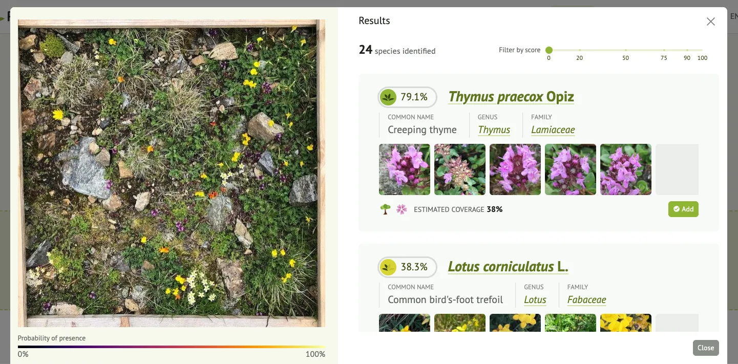
Automatically identify species
Section titled “Automatically identify species”-
If you have already uploaded an image, click the “Identify species” button under the image.
-
Check the list of species identified by Pl@ntNet and click the “Add” button if you want to add a particular species to your survey.
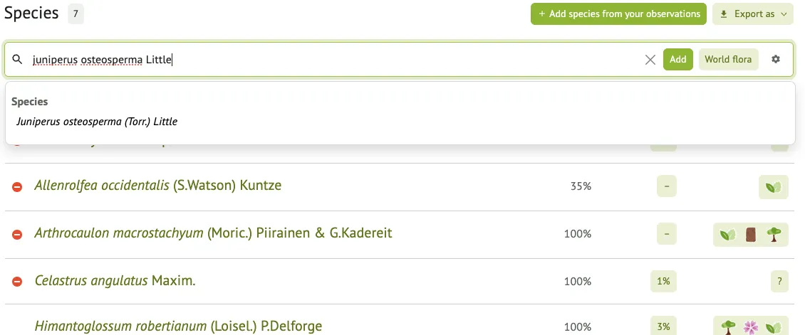
Manually adding species
Section titled “Manually adding species”In addition to automatic identification, users can manually add species to their vegetation survey using an integrated search field with auto-completion, making it quick and easy to find the right species. For each species in the survey, users can also provide additional metadata, including coverage estimates (to indicate the space occupied by the species in the quadrat) and phenological information (such as flowering, fruiting, or vegetation of the plant). These details allow for the creation of richer and more informative surveys for ecological analysis and biodiversity monitoring.
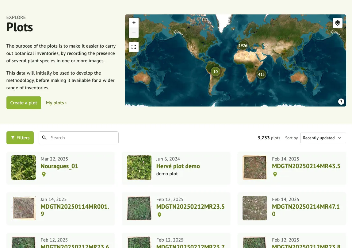
Exploring vegetation surveys
Section titled “Exploring vegetation surveys”In addition to creating your own surveys, you can also explore vegetation surveys shared by other users. These surveys provide valuable information on the diversity and composition of plant communities in different habitats and regions.
You can
-
browse surveys on a map or as a list
-
view the image, location, and date of each quadrat
-
See the species detected and their distribution in the quadrat
-
Use the surveys as a learning resource or as a point of reference for your own fieldwork.
This collaborative approach allows the development of a shared database of plant community observations powered by the Pl@ntNet community.
Beta status and feedback
Section titled “Beta status and feedback”This feature is currently in beta, meaning it is still under development. The accuracy of identification may vary depending on the quality of the quadrat image and the diversity of the scene. We are constantly improving the detection models and the user interface based on your feedback.
If you encounter any problems or have any suggestions, please do not hesitate to let us know. Your contribution helps us make this tool more robust and useful for everyone.